How do I add/remove place labels, roads, and satellite view from the base map?
▶️ Prefer video? Click here!
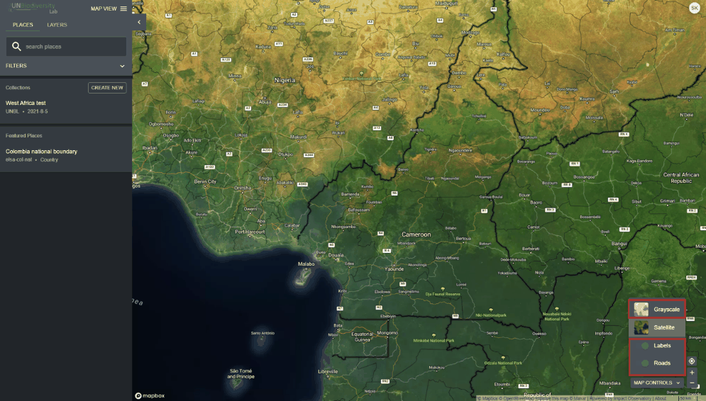
There are several options for you to customize the base map. These are available under the 'MAP CONTROLS' icon on the bottom right and include:
-
Labels: The labels show the name of the places, including countries, states, cities, and representative landmarks. Click the toggle on to activate labels, and click off to hide.
-
Roads: Click on the toggle to show roads; toggle off to hide roads.
-
Map background: We offer grayscale and satellite options for the map background. Click the toggle to activate the background of your choice.
-
3D Globe: Switch on 3D Globe, at the top of the 'MAP CONTROLS' menu, to view the map as a three-dimensional globe instead of a flat map. Switch it off to return to the flat map. Your choice is kept in the map's link, so people you share the link with see the same view.